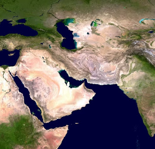
How do satellite images work? | Google maps
Google satellite images
Today, satellites imagery is one of the most popular feature
of Google Maps. Capturing the world from above is a laborious task that aims to
match millions of images with precise locations. But how do satellite images
actually work? How often are these images updated? What are the biggest
challenges in providing satellite imagery to over a billion users?
The mosaic of aerial and satellite photos that you can see
on Google Maps and Google Earth are sourced from many different vendors,
including state agencies, geological survey organizations, and commercial image
vendors. These image are taken on different dates and under different lighting
and weather conditions.
Google Earth is the platform that lets you explore over 36
million miles (1mi² = 2.59 km²) of high-definition satellite images from
various vendors, covering over 98% of the total population, to view the world
above. While these stunning photos show us parts of the world we might never
get the chance to visit, they also help Google Maps accurately model a world
that changes every day.
There is a whole industry around aerial surveys. Companies
integrate devices under planes and cameras take photos as they fly over the
target. In many parts of the world this is happening all the time.
In places where a market for aerial surveys has not been
established, satellites are used. With aerial surveys, you get very high
quality images sharp enough to create detailed maps. Satellites produce lower
quality images, but they are still useful because they provide worldwide
coverage.
Google Maps - Myanmar
Google obtains commercially available satellite images from
various vendors, and their team assembles the images to create a perfect map.
This is a process called photogrammetry which is automated through machine
learning to help accurately position images and improve resolution.
These images show us extremely important details about an
area, such as roads, lane markings, buildings and rivers, as well as the
precise distance between each of these objects. All this information is
collected without the need to set foot on the place itself.By refining the
technique of photogrammetry over the past 10 years, Google can align images
from multiple sources (Street View, aerial and satellite imagery, as well as
authoritative datasets) with an accuracy of up to one meter.
Over the past 15 years, Google has provided maps in more
than 220 countries and territories and displays useful information for more
than 200 million places.
How often do you update satellite images?
Google's goal is to update satellite images of the places
that change the most. For example, because big cities are constantly changing,
they try to update satellite images every year. For mid-sized cities, they
update the images every two years and every third for smaller cities.
The general goal is to keep densely populated places
regularly updated and to keep up with a changing world, so that the areas are
updated more frequently if you consider that there are many buildings or road
construction. In progress.
Why do we sometimes see mysterious object on maps?
Google engineers explain that sometimes the way images are
collected can create optical illusions. One of the most common case is that of
"sunken ships", which are actually sailboats that can appear
underwater due to the way satellite images are grouped into layers. Other
times, the sunlight can reflect something bright, and it will look like a
strange white object that some identify with haunted houses or other spooky
things.
Google Maps: plane
Mapping never stops and work is constantly being done to
create new tools and techniques to make image collection faster, more accurate
and safer for everyone.


Comments
Post a Comment